
- Moving Services
- Long Distance Movers
Nationwide relocation, coast-to-coast
- Local Movers
Stress-free local moving services
- Snapmoves℠ by United
Customized, seamless moving option
- International Movers
Global relocation services
- Car Shipping Services
Reliable door-to-door auto transport
- Military Movers
Proudly moving military families
- Packing & More
- Full Service Packages
Complete move management
- Packing & Unpacking
Time-saving packing & unpacking services
- Storage
Flexible short or long-term storage
- Real Estate Rewards
Earn cash back when you buy & sell your home
- Moving Protection
Coverage for peace of mind
- Resources
- Blog
Expert moving tips, insights & advice
- Moving Checklists
Complete planning tools for your move
- Moving & Packing Videos
Visual guies for a smooth move
- Moving Quotes
Understanding your online moving quotes
- Shipment Tracking
Track your shipment progress at any time
- Submit a Claim
Submit your claim online
- Corporate Services


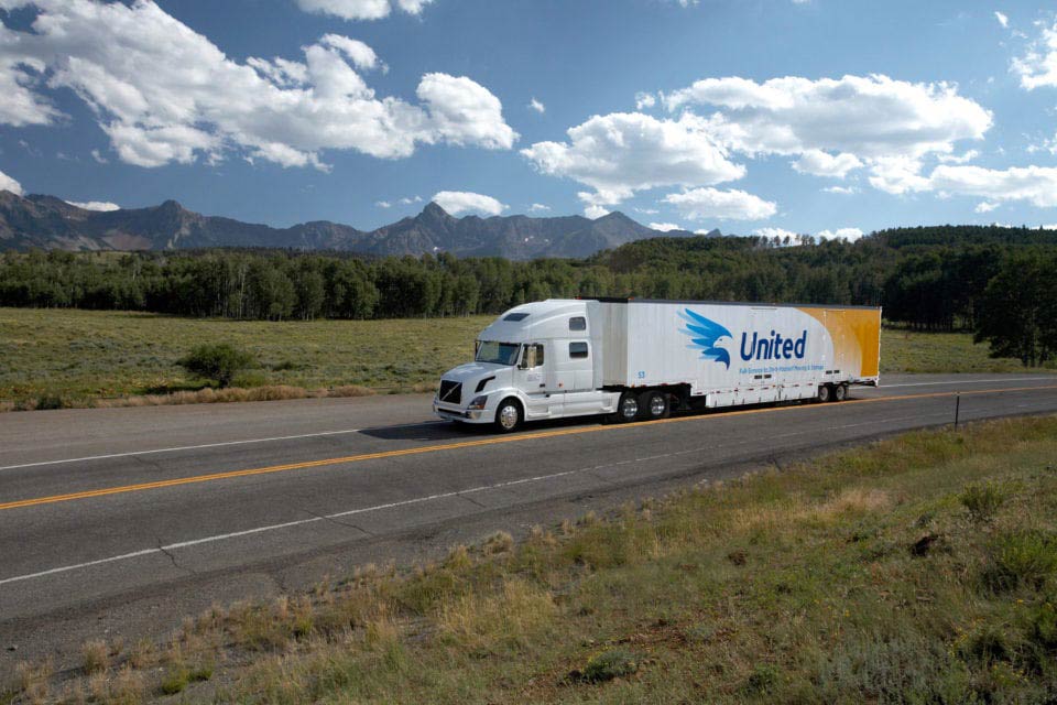

Table of Contents

Explore an unforgettable mountain wonderland in the interior western U.S., where soaring, white-capped peaks meet vast, wildlife-rich lands.
Featuring many of the crown jewels of the National Park Service, from Yellowstone to Grand Teton, preserved lands in the western U.S. top travelers’ bucket lists the world over. Revealing colossal geological wonders; ancient history; and jagged, snow-capped mountains, these majestic lands ground, challenge and amaze you at every turn.
Whether you’re a family with tots or an adventure-seeker with rock-climbing skills, there’s something to move you. And if you’re fortunate enough to live in the western U.S.? America’s breathtaking backyards are a hop, skip and a jump from home.
Considering a move to the western United States? Already settled in? United Van Lines can not only get you there, but also help you settle in, get familiar with your new neighborhood, and embrace the beauty and natural resources that surround you. The mountains, glaciers and valleys are calling — and so much more.
Tips for Visiting National Parks of the West
Get a Lay of the Land
Whether you prefer a quick weekend jaunt or a full-on vacation, it’s important to get the lay of the land before visiting the national parks, as these destinations are among the remotest areas on Earth. You’ll lack access to certain necessities; cell service can be spotty; and weather and road conditions can change in the blink of an eye.
Check the Park Website
Check the parks’ official websites for things like road and trail closures before you go — otherwise you could be met with a closed road, entrance or trail that can derail an otherwise well-planned adventure. This is the wilderness, after all, and you’re at the mercy of Mother Nature every single day.
Plan Your Routes and Pack a Map
It’s often an hours-long drive through challenging — not to mention exhilarating — driving conditions when traveling from one end of most national parks to the other. Plan your routes and map out everything in advance. It’s also a good idea to purchase hard-copy maps, like the waterproof trail map series from National Geographic. They not only include topography, but also roads and routes not detailed on regular maps — or, frankly, the ones you receive at the gate.
Time it Right
Because the parks are so vast, timing is everything. Yellowstone National Park, for example, spans 2.2 million acres. Group viewpoints and hikes by regions within the park; note the distance and time between destinations; and know how far it is to your must-sees in advance. No one wants to end up mid-mountain and crunched for time. Account for the fact that these drives can take longer than expected — mountain, unpaved and meandering roads are that way.
Consider, too, what time of year is right for your visit. In some parts of the country, the summer heat is oppressive, while winter brings seasonal road closures that render parts of the parks off-limits for months at a time. By contrast, off-season visits — spring and fall — prove more peaceful and less populated, while providing a beauty of their own. However, these can also be times when certain regions receive the most rain.
Here are some other important considerations and rules of thumb when planning national park trips:
PREP EARLY
- Get an annual national park pass
- Buy a park passport — and stamp it at each visitor’s center
- Book early — nearby accommodations fill up well in advance
TAKE SELF CARE
- Bring proper gear — and prepare for weather changes
- Dress in layers and bring a daypack
- Drink water — and lots of it
- Slather on sunscreen, regardless of the weather
- Pack a picnic, as dining options are limited-to-non-existent
TIME TO GO
- Stop by the gift shop — they tend to be great
- Gas up the night before — hours vary and options are few and far between
- Combine camping with a stay in a historic lodge or Airbnb
- Befriend park rangers for insider information
- Download park, weather and GPS apps in advance
- Check the park website for time entry requirements
- Leave no trace
Ready to get started? Let’s explore the national parks of the western U.S. and delve into their biggest draws.
National Parks in Idaho
Grand Teton National Park

LOCATION
Straddling the Idaho-Wyoming border
ESTABLISHED
February 26, 1929
AREA
310,000 acres
The Idaho side of the Tetons — known as the “Teton Valley” — is the quiet side of the Grand Tetons. It encompasses Victor, Idaho, Driggs, Idaho, and Tetonia, Idaho. Significantly less busy than its Wyoming counterpart (see the full Grand Teton National Park description under the state of Wyoming), it’s the jumping off point for explorations of the Swan Valley, Mesa Falls, the Teton River and Palisades Lake.
Consider a scenic drive along the 70-mile Teton Scenic Byway, which runs along the western slopes of the Teton Range. You’ll be rewarded with picturesque vistas, rushing rivers and historical sites.
See the full Grand Teton National Park description under the state of Wyoming.
Yellowstone National Park

LOCATION
Mostly in Wyoming, extending into Montana and Idaho
ESTABLISHED
March 1, 1872
AREA
2,221,766 acres
Mainly in Wyoming and parts of Montana (see the full description under the state of Wyoming), 2.2-million-acre Yellowstone National Park extends into parts of Idaho.
Idaho’s nearest Yellowstone entrance — the park’s busiest — brings you to geyser paradise. Plan your itinerary right and you can enjoy lookouts near Canyon Village and Artist Point and pay visits to Mammoth Hot Springs, Old Faithful and Grand Prismatic Spring the same day. Have more time? You’d be wise to stretch your stay to fully bask in the beauty.
Offering some of the best fishing and wildlife viewing in the state, the Greater Yellowstone Region is home to the gateway of Island Park, Idaho, where forests and rivers sit within the world’s the largest caldera — a nearly 50-mile hollow formed when a supervolcano erupted 2.1 million years ago.
Looking for a scenic drive? The 64-mile jaunt along Highway 191 spans two states and two mountain passes and skirts Hebgen Lake, Earthquake Lake and Henry’s Lake.
If seeing a bear tops your bucket list, a drive through Yellowstone Bear World in nearby Rexburg, Idaho, guarantees up-close sightings. The wildlife park is home to grizzly bears, black bears, elk and moose. It features a petting zoo and amusement rides, too. Cap off the detour with a stop at the Grizzly & Wolf Discovery Center, a wildlife center and educational facility with resident grizzly bears, gray wolves and river otters.
National Parks in Montana
Glacier National Park

LOCATION
Montana’s Rocky Mountains to the Canadian border
ESTABLISHED
May 11, 1910
AREA
1,013,322 acres
First inhabited by Native Americans, Glacier National Park was dominated by the Blackfeet in the east and the Flathead in the western regions around the time European explorers arrived. Featuring over 700 miles of trails that give way to alpine meadows, pristine forests, rugged mountains and crystalline lakes, Glacier National Park is a hiker’s wonderland in northern Montana, near the Canadian border. The result of glacially carved remnants of an ancient thrust fault, its snowcapped pinnacles are punctuated by plunging waterfalls and eye-popping turquoise lakes.
Majestic and authentically wild, many of its peaks are covered in glaciers year-round. Come spring, wildflowers blanket its meadows and grizzlies emerge from hibernation to wander and hunt in their unspoiled habitat.
THE FLORA AND FAUNA
Situated at the headwaters of the Pacific, Atlantic and Hudson Bay drainages, Glacier harbors an astounding array of plants and wildlife. Across the border in Canada, both Glacier National Park and Waterton Lakes International Peace Park were together designated International Biosphere Reserves and UNESCO World Heritage Sites.
The park’s floristic provinces encompass cordilleran, boreal, arctic-alpine and great plains, resulting in moist coniferous forest; a mix of barren or sparsely vegetated rocks, ice and snow; dry coniferous forest; meadows and prairies; deciduous forest peppered with aspens and black cottonwoods; wet meadows, or fens; and lake surface water with thriving aquatic plants in shallower areas. From lush grasses to a dizzying number of fern species, woody shrubs and meadows carpeted with summer wildflowers, interest abounds.
Not surprisingly, these habitats support an impressive diversity of wildlife, including majestic elk, tiny pigmy shrews and one of the largest grizzly bear populations in the lower 48 states. America’s largest rodent, the beaver, also calls the park home, along with bighorn sheep, a complex mix of fish, amphibians like the Boreal Chorus frog, more than 275 winged wonders and even western painted turtles.
THE WEATHER
Spanning the Continental Divide with more than 7,000 feet in variance above sea level, there are many climates and microclimates within Glacier.
Moist temperate conditions prevail on the west side of the park, where rainfall averages 23 inches in its dryer northeast and northwest edges and an average of 30 inches at West Glacier. Precipitation over 100 inches may fall in isolated spots near the Continental Divide.
In the Pacific watershed at the western side of the park, expect a milder and wetter climate, given its lower elevation. Winter and spring see the greatest precipitation. Snow can fall any time of the year, including summer, particularly at higher altitudes. Come winter, expect prolonged cold weather, especially on the eastern side of the Continental Divide. Winter snowfalls are significant, with the largest accumulation happening in the west. During the tourist season, daytime highs range from 60 F to 70 F, dropping into the 40 F range at night. However, high-country temperatures are much cooler. The lower western valleys, meanwhile, see summertime highs that hover around 90 F. Stay in the loop about weather conditions and road and trail closures on the park’s website.
THE HIKES, DRIVES AND VIEWPOINTS
The best day hikes are found in Many Glacier, West Glacier and Two Medicine, in addition to along Going-to- the-Sun Road.
AVALANCHE LAKE VIA TRAIL OF THE CEDARS
Among the park’s most popular hikes is moderately challenging, 5.9-mile out-and-back Avalanche Lake via the Trail of the Cedars near Lake McDonald, Montana — and for good reason since you’re treated to turquoise waters galore.
GRINNELL GLACIER TRAIL
The Grinnell Glacier Trail — a challenging, 14.9-mile out-and-back trek — showcases a bevy of glaciers, lakes, waterfalls, forests and wildlife along a highly elevated trail with steep drop-offs. Adding to the thrill, you can stand where the glacier ends and melds into the first lake. Beginning from the north side of Going-to-the- Sun Road at Logan Pass, it’s frequented by bighorn sheep and mountain goats.
GOING-TO-THE-SUN ROAD DRIVE
No matter what — and especially if your time is limited — make certain to drive along 50-mile Going-to-the-Sun Road, storied for its dramatic mountain scenery. Its lower portion is open year-round, though the alpine section may not open until sometime in early July, once the gargantuan task of plowing the road is done.
CRACKER LAKE TRAIL
One of the park’s most spectacular hikes, the 12-mile, out-and-back Cracker Lake Trail starts at Piegan Pass at the south end of the parking lot above the Many Glacier Hotel. Marvel at the Cracker Flats area; pause to appreciate the mountains vistas across the upper reaches of Lake Sherburne; take in the soothing sounds of creeks and waterfalls; witness deep, steep-walled canyons; and keep watch for grizzly bears (bear spray is a must), particularly as you pass through dense vegetation.
National Parks in Wyoming
Grand Teton National Park

LOCATION
Straddling the Idaho-Wyoming border
ESTABLISHED
February 26, 1929
AREA
310,000 acres
Richly scenic with exceptional wildlife, untouched lakes, massive mountains and alpine terrain, Grand Teton National Park is nestled into the northwest corner of Wyoming in Teton County, a few miles south of Yellowstone. Its 310,000 acres of wilderness are crossed by about 200 miles of trails. In conjunction with the surrounding national forest, the three protected areas comprise the almost 18-million-acre Greater Yellowstone Ecosystem, one of the planet’s largest intact, mid-latitude, temperate ecosystems. ` The region’s human history is fascinating and rich. Dating back at least 11,000 years, the first hunter-gatherer Paleo-Indians migrated here during warmer months in search of food and supplies. By the time Europeans arrived, tribes — including the Shoshone, Blackfoot, Bannock, Flathead, Blackfoot, Crow, Gros Ventre and Nez Perce — were harvesting bounty from the land. From tales of fur trappers to the stories of homesteaders and ranchers, even its more recent history runs deep.
THE FLORA AND FAUNA
Rising more than 7,000 feet above the valley of Jackson Hole, the commanding Teton Range defines the skyline. Ascending from the sagebrush-specked valley floor to the 13,770-foot summit, its forests give way to meadows that come alive with wildflowers when weather warms. Crystal-clear alpine lakes — mirroring mountains — fill amphitheater-like glacial cirques; rushing streams plummet down rocky canyons into pristine lakes at the foot of the mountain range; and the Snake River weaves its way through the valley and across the vast landscape.
Supporting over 1,000 species of vascular plants, Grand Teton is divided into communities of sagebrush flats, like those seen on the valley floor of Jackson Hole; forests in canyons, on mountainsides and along ridges; riparian corridors and wetlands that produce ribbons of green, moisture-loving plants along the Snake River; and alpine areas, matted with specially adapted species, like forget-me-nots.
These create habitats for yellow-bellied marmots, mighty grizzly and black bears, moose, wolves and mountain lions, as well as rarely seen wolverines, over 300 species of birds, and many native fish and salamanders. The park also harbors several species of concern, from the bald eagle to the greater sage grouse and gray wolf.
THE WEATHER
Mid-April through June, pleasant days and cool nights alternate with pockets of rain and snow. In fact, trails on the valley are usually covered with the white stuff until late May. The months of July and August are warm, with temps cooling off in the evenings and afternoon thunderstorms a common occurrence. September through November is sunny and cold, offset by rain and occasional snow. Winters are frigid and unforgiving, with snow swathing the mountains and valley and all-winter tires highly recommended but really a must. Roads may close during blizzards.
Conditions can change rapidly here. It’s important to monitor the park’s website for current road, trail and weather conditions.
THE HIKES, DRIVES AND VIEWPOINTS
CASCADE CANYON TRAIL
A remarkable, albeit moderately challenging, 9.1-mile route to the Grand Tetons’ Cathedral Group, the Cascade Canyon Trail requires taking the Jenny Lake shuttle boat across the glacially carved, 423-foot-deep water to the trailhead — that is, if you want to cut off roughly 2.4 miles of walking each way via the alternate Jenny Lake Trail. The trek climbs through a pristine conifer forest, crossing Cascade Canyon Creek; passing thundering Hidden Falls; visiting Inspiration Point for a breathtaking perspective of Jenny Lake, Jackson Hole and the Gros Ventre Mountains; entering boulder fields; trekking along ponds frequented by harlequin ducks; and heading to the Forks of Cascade Canyon.
DELTA LAKE VIA THE LUPINE MEADOWS ACCESS
Hike to beautiful, secluded Delta Lake via the Lupine Meadows Access on a challenging, 8.1 mile out-and-back trail that gains 2,300 feet in elevation (about twice the height of the Empire State Building). Located in the southwest corner of the park, it’s an unmaintained trail that’s typically accessible only from June through October due to persistent snowfall. Trek up a series of switchbacks for vistas of Bradley Lake and colorful spring and summer wildflowers. After scrambling through boulder fields for a final 500-foot ascent, you reach the placid, glacial lake.
JENNY LAKE TRAIL
A 7.1-mile-long hiking trail that begins at the Jenny Lake campground and encircles its namesake body of water, the Jenny Lake Trail takes you first along the mostly forested east side of the 423-foot, glacially carved lake for views of Teewinot Mountain, Mount Owen, Cascade Canyon, Storm Point, Symmetry Spire, Mount St. John, Rockchuck Peak and Mount Moran. One of the most popular and easiest hikes in the park, the trail provides access to the Cascade Canyon Trail and is overlapped by the Valley Trail along the lake’s west side.
LAKE LOOP
A moderate 6-mile option, Taggart Lake and the Bradley Lake Loop winds through aspen-covered moraine before opening to views of the mighty Tetons.
HIDDEN FALLS TRAIL
The easy, 4.8-mile Hidden Falls Trail can be shorted a mile by taking the shuttle boat to the Jenny Lake Loop Trail, culminating in a panorama of the roaring 200-foot waterfall that cascades down rocky ledges at the far end of the lake. Continue across a wood bridge to the north side of Cascade Creek before climbing rugged switchbacks up a granite knoll to 7,200-foot Inspiration Point, where you’ll be rewarded with perspectives that extend over Jenny Lake to the Gros Ventre Mountains and the Gros Ventre Slide, a massive 1925 landslide. Other views include Storm Point and Symmetry Spire to the west and, to the southwest, Teewinot Mountain as it looms over Cascade Canyon.
SURPRISE & AMPHITHEATER LAKES TRAIL
The 10.1-mile Surprise and Amphitheater Lakes Trail — which climbs 3,000 feet — takes you to two alpine lakes, a journey through meadows and forests and up a series of switchbacks to views of the surrounding peaks.
Yellowstone National Park

LOCATION
Mostly in Wyoming, extending into Montana and Idaho
ESTABLISHED
March 1, 1872
AREA
2,221,766 acres
Mostly in Wyoming, Yellowstone National Park spreads into parts of Montana and Idaho. The world’s first national park, 2.2 million-acre Yellowstone National Park is a land of geysers and hot springs; mud pots and fumaroles; meadows; dramatic canyons; and pine-scented forests. Shaped by a volcano, thermal features, glaciers and earthquakes, it’s a sanctuary for the continent’s largest population of elk and the continent’s oldest, largest herds of wild bison, as well as both grizzly and black bears. In short, it promises a North American safari for the ages.
Drawing people from all corners of the world to appreciate its unique hydrothermal and geologic features, Yellowstone contains roughly half of the world’s active geysers, as well as one of the planet’s largest, almost-intact temperate zones.
THE FLORA AND FAUNA
Complex and wondrous, the ecosystems of Yellowstone National Park protect a wide array of terrestrial, aquatic and microbial life, including the largest concentration of mammals in the lower 48 states. That includes eight ungulate species — bighorn sheep and mountain goats among them — as well as seven large predators: The Canada lynx, mountain lions, coyotes, black bears, grizzly bears, wolves and wolverines.
From resident and migratory birds to fish like the Yellowstone cutthroat trout; amphibians, such as chorus frogs; and reptiles that include the prairie rattlesnake and rubber boa, it’s a feast for the eyes — and senses.
Of course, plant life is no less fascinating here, with vegetation that overlaps species typical of the Rocky Mountains, Great Plains to the east and intermountain region to the west. In addition to three endemic species — Yellowstone sand verbena, Yellowstone sulfur wild buckwheat and Ross’s bentgrass — you’ll find mountain and common juniper, quaking aspen and cottonwood as well.
THE WEATHER
Given most of the park lies at 6,000 feet or higher above sea level, climactic unpredictability can lead to sudden changes in weather, including wild temperature swings and rain or snow any month of the year. Spring and fall see temperatures between 30 F to 60 F during the day, dipping to teens or single digits at night. Come summer, temperatures can reach 80 F at lower elevations, cooling off as mountain regions do at night. With an annual average of 150 inches of snow (though high elevations can see double that), sub-zero temperatures are common in winter. The lowest recorded temperature? A bone-chilling -66 F.
THE HIKES, DRIVES AND VIEWPOINTS
GRAND PRISMATIC OVERLOOK TRAIL
There’s no way around it — you have to walk the 1.5-mile, out-and-back Grand Prismatic Overlook Trail, which gradually climbs 105 feet from the Fairy Falls Trailhead for a bird’s eye view of Grand Prismatic Spring, the largest hot spring in the United States and the third largest in the world. More than 120 feet deep and located in the Midway Geyser Basin, it radiates exceptionally hot water — and a rainbow’s worth of color — from its center.
UPPER GEYSER BASIN & OLD FAITHFUL OBSERVATION POINT LOOP
Equally must-do is the 4.9-mile Upper Geyser Basin and Old Faithful Observation Point Loop. Reached behind the Old Faithful Visitor Education Center, it’s the best trail for viewing the park’s hydrothermal features and specifically the most predictable geysers, including Old Faithful, Daisy, Riverside, Castle and Grand. Be sure to check the geyser times board above the ranger’s desk before heading out. From Observation Point, you’ll glean the Historic Old Faithful District, most of the steamy geyser basin and the star of the show, Old Faithful.
MYSTIC FALLS, FAIRY CREEK & LITTLE FIREHOLE LOOP
Mystic Falls, Fairy Creek and Little Firehole Loop total 3.5 miles, revealing 70-foot Mystic Falls, a geothermally heated waterfall; the Biscuit Basin, where boardwalks are flanked by colorful springs; and the Little Firehole River at an elevation of 7,264 feet.
FAIRY FALLS TRAIL
Easy, flat and meandering, the 4.8-mile Fairy Falls Trail affords views of its spectacular water feature about 2.5 miles in. One of Yellowstone’s tallest, it’s situated in a bear-populated area, so be sure to bring bear spray and engage in conversation as you go.
YELLOWSTONE FALLS, CRYSTAL FALLS & INSPIRATION LOOP
Take the 6.4-mile hike to Yellowstone Falls, Crystal Falls and Inspiration Point for classic Upper and Lower Yellowstone vantage points, including an aerial view of rugged, deep Grand Canyon of the Yellowstone.
MAMMOTH & HOT SPRINGS TRAILS
Not to be missed are the Mammoth and Hot Springs Trails, the features’ volcanic heat source still somewhat of a mystery. Although the beautiful, colorful terrace steps do not have any high-spouting geysers, the region does contain the world’s greatest collection of hot springs comprised of travertine deposits. These “living sculptures” can be seen by walking a series of boardwalks or — if you’re crunched on time — from your car window on Upper Terrace Drive.
Whether you live in the interior west states, are considering a cross-country move to these states or are planning a visit, our blog is filled with ideas to experience the region through a local lens.
Heading to another part of the country, whether to move, for business or for pleasure? Be sure to check out our other national park guides:
Ready to make a move with United Van Lines? We’re ready when you are! So, let’s talk.
Categories
Share
Related Articles

Spring/Summer 2026 House Key

What to Do When Your Neighbor’s Home is an Eyesore

Launch States, Midlife Moves and Second Acts

Choosing What Fits: United Van Lines’ 2025 Movers Study
Professional Moving Services Made Easy
Recent City Guides
View All
Top Cities: Where Americans Moved in 2025
In 2025, Americans continued to move. However, they did so with sharper intent. Read how Americans are on the move per the United Van Lines 49th Annual National Movers Study.

Moving to New Orleans, LA: Your Complete Relocation Guide
Thinking about moving to New Orleans, LA? Known for its culture, food and music, the city also offers quite an affordable cost of living and a diverse job market — making it a vibrant place to call home.

Pros and Cons of Moving to Shreveport, Louisiana
Considering a move to Shreveport, Louisiana? This guide breaks down real benefits and drawbacks, including lifestyle, cost of living, job market and culture. Get the facts before making your move!

Pros and Cons of Moving to Baton Rouge
Find out if moving to Baton Rouge is for you. Discover the positives and negatives of living here, from the economy to culture, and decide for yourself.
Ready to Get Moving?
Choose United Van Lines — America’s #1 Mover®